Leasing request
This bundle consists of:
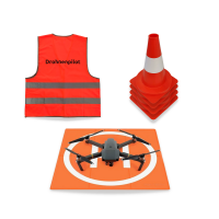
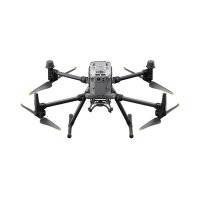
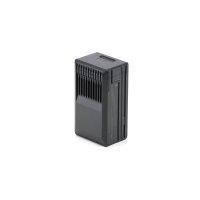

- Available immediately
-
Delivery time: 1 - 3 Workdays (DE - int. shipments may differ)

- Available immediately
-
Delivery time: 1 - 2 Workdays (DE - int. shipments may differ)

- Available immediately
-
Delivery time: 4 - 5 Workdays (DE - int. shipments may differ)

- Available immediately
-
Delivery time: 2 - 3 Workdays (DE - int. shipments may differ)

- Available immediately
-
Delivery time: 2 - 3 Workdays (DE - int. shipments may differ)

- Available immediately
-
Delivery time: 2 - 3 Workdays (DE - int. shipments may differ)

- Available immediately
-
Delivery time: 2 - 3 Workdays (DE - int. shipments may differ)

- Available immediately
-
Delivery time: 2 - 3 Workdays (DE - int. shipments may differ)
Description
Up to 50% time saving compared to non-RTK drones
The drone has real-time kinematics (= RTK), which allows the drone's position to be determined horizontally by less than 2 cm. You save up to 50% working time compared to non-RTK drones when calibrating on site and in post-processing.
Few to no control points
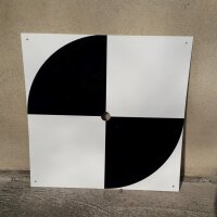
The time-consuming measurement of many control points is no longer necessary. Only three control points are required for georeferenced models. Additional points can be used for control purposes.
Leading photogrammetry software
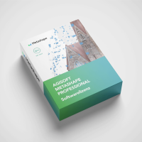
The included photogrammetry software leaves nothing to be desired, even for professional surveyors. A four-hour online training course teaches beginners and advanced users how to use the software profitably.
Instant georeferencing for RTK
The drone has real-time kinematics (= RTK), which allows the drone's position to be determined horizontally by less than 2 cm. A SIM card is inserted into the remote control for this purpose.
Survey large areas and still be flexible
The system is an industrial drone that has been trimmed for performance with a breathtaking area performance of 200 ha per hour
Full-format camera with 45 MP
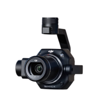
You get a very high-resolution camera with a large image sensor. This allows the drone to fly very high and still take accurate pictures. The sensor size of 36 x 24 mm ensures good images even in poor lighting conditions.
LIDAR & Co.: Expandable and future-proof
The camera is interchangeable. If required, simply switch to a laser scanner or an inspection camera.
Ready-to-fly
Don't have time for hours of set-up? Our packages arrive ready-to-fly by post or are flown out in person.
The comparison
Surveying package 50 ha

- DJI Mavic 3E with RTK module
- 70 m flight altitude
- 2 cm/px Ground resolution
- 50 ha per hour Surveying performance

Survey package 200 ha

- DJI M300 RTK
- 120 m flight altitude
- 2 cm/px Ground resolution
- 200 ha per hour Survey performance

Surveying package 400 ha

- WingtraOne
- 120 m flight altitude
- 2 cm/px Ground resolution
- 400 ha per hour Survey performance

Demo project
Visit our demo projects page for more examples and download our free sample data.
Customer reviews
Airclips Vermessungspakete können wir nur empfehlen. Aufmaß- und Volumenbestimmungen mit einer
Drohne sind blitzschnell gemacht! Von dem Airclip-Team rings um Herrn Günther wird man ordentlich
beraten und hat bei Fragen immer einen Ansprechpartner. Absolute Profis für den professionellen
Drohneneinsatz.
Firma W. Guenther und Soehne GmbH & Co.KG
Also ich muss hier mal wirklich ein dickes Lob aussprechen. Bei dieser Firma steht der Servicegedanke ganz weit vorne.
Vom Erstkontakt zu dem überaus sehr kompetenten und auch immer für mich erreichbaren Verkäufer, bis zur Auslieferung der
ersten Vermessungsdrohnen blieben keine Fragen unbeantwortet. Ein ganz großes Dankeschön an Marc und Daniel.
Der Einsatz der Drohnen war für uns durch euer herausragendes Engagement vom Start weg ein voller Erfolg und erspart uns
so viel Zeit. Vielen Dank! Wir freuen uns auf die Partnerschaft und auf viele spannende Projekte.
Da kommt noch was, versprochen!
Andreas von GIGA.GREEN GmbH, 10557 Berlin
Top Service als B2B Partner in Sachen Vermessungsdrohnen. Immer hilfsbereit und
bei Rückfragen jederzeit erreichbar. Vielen Dank, Airclip, für die gute
Zusammenarbeit von Anfang an und hoffentlich noch für sehr lange.
Anonym am 23.10.2023
Die Firma Airclip bietet auf allen Ebenen einen sehr guten Service. Bei der
Beratung konnte man sich von dem Fachwissen der Ansprechpartner überzeugen,
welches dann bei der Schulung nochmals bestärkt wurde. Insgesamt war die
ganze Abhandlung von der Beratung über den Kauf bis zur Schulung ein sehr
zufriedenstellender Prozess, der alle Wünsche erfüllt hat.
Tell Bau GmbH, 26506 Norden
FAQ
How exactly do control points work?
Control points are georeferenced points on the ground that serve as a reference for the drone and the photogrammetry software. With RTK drones, only a few control points are required as the drone itself provides very accurate position detection.
Is the surveying package suitable for beginners?
Yes, the package includes an online training course that is suitable for both beginners and advanced users to learn how to use the drone and software.
Can I use the drone for tasks other than surveying?
RTK drones can be used for a variety of applications, such as construction monitoring, agriculture, mapping and inspections.
