Forestry & agriculture packages
Helpers in agriculture and forestry
Drones enable agricultural businesses to remain competitive in the long term. Their main advantages are their speed of movement and data processing, as well as their wide range of possible applications.
Drones can provide efficient support for the rapid and wide-ranging detection of forest damage caused by storms or pests in forestry. Checking plant growth and forest inventory 4.0 are also within the realm of possibility.
Furthermore, they can support forestry in the search for and monitoring of wildlife populations and their spread.
Increase revenue through precision farming
Drones provide a quick overview of your fields and cultivated areas, regardless of the terrain. This enables you to quickly identify damage or check plant growth using aerial images.
New technology enables even more in-depth support. Near-infrared spectroscopy (NIRS) and multispectral cameras are key here. They can also be used in combination.
Near-infrared spectroscopy
It is almost impossible to distinguish between healthy and diseased plants with the naked eye. Near-infrared technology exploits differences in reflection behavior due to varying chlorophyll content. The technology examines light in the wavelength range between 760 and 900 nanometers. The information obtained can be used to monitor the condition and growth of plants. This enables inventory counting and evaluation in forestry and the assessment of fields for pest infestation and plant growth.
Multispectral camera
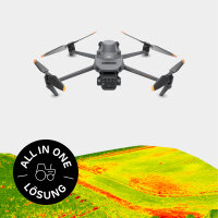
Multispectral technology uses a broader wavelength range than the human eye can perceive. This makes it possible to determine the condition of plants based on the reflected daylight. The Normalized Difference Vegetation Index (NDVI) is used to evaluate the images. This provides data on the vitality of the plants, which allows conclusions to be drawn about sparse vegetation or diseased plants. In combination with light measurements, this enables you to analyze the vitality of entire crops. You can then decide whether to optimize the fertilization process, optimize irrigation, or use pesticides. Targeted use of pesticides and local fertilization protect the environment and reduce your expenses.
Sustainable farming with drainage detection
Old, clogged drainage systems can be a problem for uniform irrigation of the field. Drones make it easy to take aerial photographs and determine the course of the drainage system based on soil moisture. This allows affected areas to be repaired quickly.
Fawn rescue
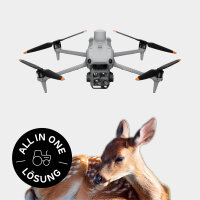
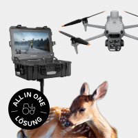
A cross-industry application can be found in fawn rescue. Fawns are difficult to see in fields. Drones with thermal imaging cameras detect heat signatures in the field, create a thermal image, and enable the fawns to be identified before harvest, allowing countermeasures to be taken to ensure their survival and a quick harvest.
Forest inventory 4.0
Inventory counting and monitoring of forest structure are of great importance for forestry.
Drones far surpass satellite or conventional aerial imaging systems with their images. They are cost-effective, more accurate, and provide more detailed information. They are also quick and easy to operate.
The images taken from the air enable photogrammetrically accurate, three-dimensional models of individual trees or forest structures to be created. With these images, also in combination with NIRS or multispectral cameras, you can analyze the vitality of trees, tree height, crown condition and structure, growth, and even areas of damage.
Economic efficiency through low calamity
You can detect diseased plants and pests at an early stage using NIRS and multispectral cameras. This allows you to intervene and prevent pest infestation (e.g., by bark beetles).
Analysis of wildlife populations
The use of drones with thermal imaging cameras brings the detection of thermal signatures to the fore. This enables the monitoring and analysis of the spread of wild animals or the detection of sick or injured animals.
Discover more
Surveying with a drone
Learn more about aerial surveying with our free guide.
Simply create 3D models
With the Airclip Cloud, you can quickly and easily create dimensionally accurate 3D models for your planning from your drone images.
Industry bundles
Everything from a single source. Drone, software, training and service for a carefree start.
Drone license
It all starts with the right training.


