Leasing request
This bundle consists of:
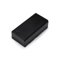
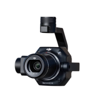
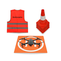


- Available immediately
-
Delivery time: 1 - 3 Workdays (DE - int. shipments may differ)

- Available immediately
-
Delivery time: 2 - 3 Workdays (DE - int. shipments may differ)

- Available immediately
-
Delivery time: 2 - 3 Workdays (DE - int. shipments may differ)
Description
2 to 4 centimeters accuracy
The Zenmuse P1 camera allows you to capture data accurate to the centimeter in combination with real-time position and orientation compensation technology.
More reliable results with RTK
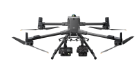
The RTK system improves the absolute positioning accuracy of the drone from several meters to two centimeters. This gives you reliable results and an additional safety net. The system is integrated into the M350 and is highly recommended for larger projects covering several thousand square meters.
Simple workflow
You tell the drone in the office where to fly, and the drone automatically takes the necessary images. In the accompanying software, the images are processed into a 3D model with just a few clicks, and you are ready to measure. Lengths, areas, and volumes can be recorded directly in the software.
Leading photogrammetry software as Software as a Service
If you don't want to process data on your own computer and want your results to be available anywhere, you can use the Airclip Cloud. Simply upload your images and wait for the results. The costs are manageable and quickly pay for themselves compared to managing your own infrastructure.
Export to PV*Sol
The 3D models created can be easily exported to PV*Sol. This allows you to use the captured data directly for the planning and design of photovoltaic systems.
Visual inspection – fast, safe, and affordable!
The M30T also impresses across the board when it comes to visual inspection of PV systems. With the help of the DJI Zenmuse, you can detect even the smallest damage to PV modules, connectors, or cables—without the expensive use of scaffolding or aerial work platforms.
All-inclusive package from Airclip
Our packages include everything: hardware, software, training, and support. We accompany you until everything works as desired—that's our promise.
Drone license included
You need a drone pilot license to operate legally. Training is included and you get everything from a single source. Airclip has been certified as a designated body PStF 006 by the German Federal Aviation Authority (LBA).
over 500 satisfied customers
Benefit from the experience of over 500 satisfied customers.
Functioning solutions
As an independent dealer, we select the products on the market that work for our core industries.
Ready to fly
Don't have time for hours of setup? Our packages come ready to fly by mail or are pre-flown in person.
demonstration project
On our Demo Projects page, you will find examples and can download our free sample data.
Customer reviews
Wir nutzen den Airclip Service um komplexe Dächer in PVSol schnell und genau planen zu können.
So sinkt der Zeitaufwand für unsere Dachplaner erheblich und die Kunden freuen sich über ein cooles
3D Modell vom Haus. Am Ende passt alles dann genau so aufs Dach wie geplant!
Christoph Glaubke von Enerix, 26655 Westerstede
Die zeitnahe Bearbeitung der 3D-Daten funktioniert einwandfrei. Das Fliegen ebenfalls. Auch individuelle Wünsche werden schnell eingearbeitet. Dazu gibt es viel hilfreiches Online-Material und persönlichen Support. Wir sind sehr zufrieden!
Solarwatt GmbH, 01109 Dresden
Unser Drohnen-Team kann mit den Drohnen und der Software von Airclip alle Auffälligkeiten sehen
und Dächer vermessen!
Tony Friedrich von Energiekonzepte Deutschland GmbH, 04347 Leipzig
Wir erstellen nur noch Ausführungspläne mit der Drohne da wir hier genauer sind also ohne Drohne
zuvor. Auch die Zeitersparnis gegenüber der Vermessung von Hand ist riesig. Da Wir keine
Dächer mehr besteigen müssen ist auch der Punkt Sicherheit sehr wichtig. Ein Vermessen ohne
Absturzsicherung ist in der Praxis nicht mehr zu vertreten. Die Technik ist sehr zuverlässig auch
bei schwierigen Verhältnissen ist diese Dank einfacher Bedingung immer sicher zu beherrschen. Wir
haben bisher über 200 Objekte befolgen und sind sehr zufrieden. Bei der Menge an Anlagen die wir
umsetzen ist das innerhalb weniger Monate bezahlt. Je nach Umfang der Anlage liegt die Zeitersparnis pro
Objekt zwischen 30 und 90 Minuten. Da die Daten digital und in hoher Qualität vorliegen ist die
Weiterverarbeitung auch sehr schnell und gut.
Kenny Breuer von Staudt GmbH, 76698 Ubstadt-Weiher
Wir arbeiten seit einem halben Jahr mit der Firma Airclip zusammen, die für uns 3D-Modelle für
unsere Kundenobjekte liefert. Der Cloud-Service für den Datenaustausch ist unkompliziert und
lässt sich reibungslos in unsere eigenen Unternehmensprozesse integrieren. Die gelieferten
3D-Modelle sind stets zeitnah verfügbar, von hoher Qualität und hieven unsere
Photovoltaik-Anlagenplanungen auf ein neues Level. Die Zusammenarbeit mit dem Airclip-Team war stets
kooperativ und professionell.
Manuel Madiener von Solmotion Project GmbH, 88214 Ravensburg
Airclip ist unser Partner für Dachaufmaße, Inspektionen und rechtliche Themen rund um
unser Drohnen-Team. Wir sind sehr zufrieden mit den empfohlenen und gelieferten Drohnen und Software-Lösungen!
energiehaus blechinger GmbH, 38448 Wolfsburg
Dank der smarten Lösung von airclip können wir unseren Kunden maßgeschneiderte Angebote
für PV-Anlagen erstellen.
Tobias Schwarz von Elektrotechnik Karl Schwarz GmbH, 89362 Offingen
Unsere Zusammenarbeit mit der Firma Airclip ist sehr kooperativ und wir sind froh, einen innovativen
Partner an unserer Seite zu haben. Der Mehrwert für unsere Kunden/Projekte durch den Drohneneinsatz
ist deutlich spürbar.
Andreas Alkens von Ailutec, 26826 Weener
Einfaches Dachaufmaß. Schnelle, unkomplizierte Erstellung der Obj-Datei.
Knut Schaeffter von Edling & Schaeffter GmbH, 65428 Rüsselsheim
Immer schnell wenn Hilfe benötigt wird, sehr freundlich und sehr kompetent. Alles funktioniert so wie
versprochen.
Sven Dönnewald von ewenso Betriebs GmbH, 33449 Langenberg
Persönlicher und schneller Service. Das Unternehmen ist sehr Kundenorientiert aufgestellt. Bin sehr
begeistert.
Julian Wolf von Energiesysteme und Dienstleistungen Julian Wolf, 79802 Dettighofen


