Contents
Short route deviations, slight drone drift during zoom shots, weak reception for the RTK network in the middle of the field—when inspecting PV systems, one detail is often enough to turn good images into unusable data. If you want to deliver accurate, comparable results, you need more than just a good drone. We'll show you how to get the most out of the D-RTK 3 multifunction module from the Matrice 4T.
Clean flight paths for every mission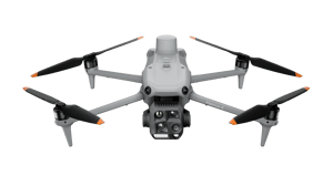
If you regularly inspect PV systems, you need exact repeatability. Especially for maintenance flights that take place at fixed intervals, it is important that the drone always flies exactly the same route. Even small deviations make comparison difficult – especially with thermal images.
Standard GNSS (such as GPS, Galileo, GLONASS, Beidou) has an accuracy of about 5 to 10 meters in open fields. This is sufficient for navigation, but not for repeating a flight route exactly or locating modules with centimeter accuracy. This is where RTK (Real-Time Kinematic) comes into play.
The D-RTK 3 Mobile Station establishes its own reference connection. It corrects the satellite signals in real time and reduces the position deviation to a few centimeters. This often reduces position deviations to less than 3 cm horizontally. This precision ensures that the Matrice 4T still flies its route accurately even on its tenth flight.
This is crucial for recurring PV inspections: thermal maps or anomaly reports can only be reliably compared if the image position and camera angle are always the same. RTK can make all the difference, especially with platforms such as Sitemark, which automatically detect modules and track anomalies.
Zoom without blurring – even at 56x magnification
The Matrice 4T offers a powerful 56x hybrid zoom. This allows you to see details such as cell cracks, dirt, or corroded contacts without having to fly close to the modules.
However, the stronger the zoom, the more sensitive the camera is to even the slightest movements. Even a slight positional deviation due to wind or GPS drift is enough to blur the image or render it unusable.
With RTK, the drone is practically "nailed" in the air. Precise position stabilization ensures that even greatly enlarged images remain razor sharp. Repeated zoom-ins at the same spot are also no problem, e.g., to track repairs or changes.
This saves you follow-up flights, reduces waste, and delivers exactly the footage you need.
Precise location without GCPs – ideal for large fields
Typically, so-called GCPs (Ground Control Points) are used for precise image localization. These must be measured on site and remain visible during the flight – an enormous factor in terms of time and cost.
The D-RTK 3 allows you to dispense with GCPs. The RTK signal provides the drone with such precise geocoordinates that images can be located with centimeter accuracy even without external reference points. For platforms such as Sitemark, this means that the drone takes off and you receive automatically located data – without manual image mapping or additional surveying work. This is an enormous efficiency gain, especially for large PV systems.
No network? No problem!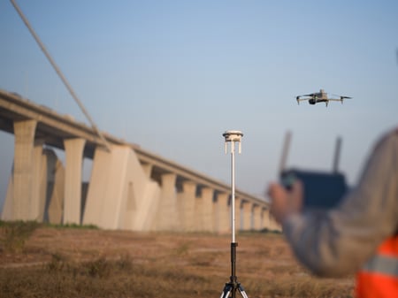
PV systems are often located where mobile communications do not work reliably. This is a problem for many RTK systems.
Many RTK systems rely on a connection to an NTRIP service that provides correction data via the Internet. However, this is often not an option for remote open-air installations – either there is no network coverage or the connection is unstable.
The D-RTK 3 completely circumvents this problem. It functions independently as its own base station. Once set up, it transmits the RTK signal directly to the Matrice 4T via radio. No mobile phone reception, no SIM card, no cloud. This makes you independent, more flexible, and, above all, significantly more reliable in your planning.
More control, better reports, more efficient operations
With D-RTK 3, your PV inspections become more predictable, reproducible, and technically clean. You get:
- reliable flight stability, even in windy conditions or with poor GNSS coverage
- precise zoom shots with repeatable camera perspective
- exact image localization without GCPs or post-processing
- cleanly structured data for platforms such as Sitemark
- full functionality even without an internet connection
This quickly pays off, especially for regular inspections, assessments, or monitoring of large solar parks. You reduce sources of error, save time in preparation, and achieve significantly higher data quality.
Would you like to know whether the combination of D-RTK 3 and Matrice 4T is suitable for your use case? Then get in touch with us!
Discover more
Surveying with a drone
Learn more about aerial surveying with our free guide.
Simply create 3D models
With the Airclip Cloud, you can quickly and easily create dimensionally accurate 3D models for your planning from your drone images.
Industry bundles
Everything from a single source. Drone, software, training and service for a carefree start.
Drone license
It all starts with the right training.